|
A few updates now that its winter.
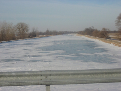
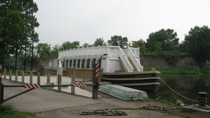
US Speedskating has been back in action with the season well under way. Illinois skaters have continued to perform well at the national and international levels, with numerous gold medal finishes at World Cup stops for Shani Davis in long track, while on the short track, Katherine Reutter has managed numerous gold medal finishes as well. But since this website is more about long-distance ice skating, a special mention of Jonathan Kuck of Champaign, IL, for his continued success at the international level with a second place finish in the 5000 meter event at the meet in Berlin, a third at 5000 meters in Heerenveen, and a top-ten finish at 10,000 meters in Hamar. Results are available at the US Speedskating website or the International Skating Union's pages on Speed Skating or Short Track. It’s too bad that Universal Sports hasn’t had the television coverage of speed skating as they had in the past few years, but some of the meets have been webcast and perhaps a search might yield webcasts of foreign broadcasts. Interesting to see the Friends of the Hennepin Canal launching the Renaissance Project, which would restore several of the locks to working order, with the goal of having approximately 50 miles (80.5 km) of waterway available for recreational cruising. The canal is fragile given its age, and has ongoing maintenance needs in the face of erosion, damage from weather and the elements, and continued siltation and the occasional natural debris (trees, etc.) falling into the canal. Learn more about the project on the link above. Or better yet, get involved or make a donation. Maybe someday there will be as much enthusiasm for the Hennepin Canal as there is for the canals of the Elfstedentocht route in the Netherlands, where the Dutch government "...is spending the equivalent of $650 million to dredge the canals...to assure they are an even five to six feet in depth. That is because the canals are increasingly used for other events patterned after the 11-Cities Tour, even when there is no ice, [such as] rolling-skating races, and bicycle races, rowing races, and even, last summer, a race of solar-driven boats.” [NY Times: At Dutch National Pastime's Top Event, Mother Nature Wields the Starting Gun, Feb 26, 2007] This blog wrote about the rowing marathon in a post last June, complete with links to a few videos.
0 Comments
Anyone wishing to bicycle between the Hennepin Canal Trail and the I&M Canal Trail cannot do so other than by riding on highways and roads for the approximately 15 - 20 mile (24 - 32 km) distance between the two trails. A planned connection has been in the works for several years with it being named the Kaskaskia Alliance Trail. It was drawn and marked as "under construction" on the 2008 version of the Illinois DOT bicycle map for the region. The version of the map I have shows a trail that utilizes an abandoned railbed, making for a direct connection between the eastern end of the Hennepin Canal trail near Bureau Junction and the western end of the I&M Canal Trail near LaSalle / Peru. In this design, the trail would use an abandoned railbed right-of-way that runs alongside a railroad track that is a single-track rail line currently used by the Iowa Interstate Railroad. (As an aside, note that it was pointed out to this blog that the abandoned railbed is owned by a real-estate entity). This would be what the Rails-to-Trails Conservancy calls a "Rail with-Trail", of which there are over 100 similar trails in the US, as opposed to a Rail-Trail, where the trail completely replaces all railroad tracks. However, the DOT bicycle maps will probably not show this connector trail as "under construction" in the future, or if the map does, it will now likely have a new routing.
I have been unable to obtain much in the way of official information about the connection between the canal trails and my understanding is that the preliminary engineering is being completed, that it has been a difficult project, and that it will likely be a combination of trails and on-road routing. Rather than being entirely a Rail-with-Trail, it will use a combination of roads and highways and maybe(?) some trails. Given the course will use on-road routing, this represents a compromise to the concept of the trail network--the two canal trails and their connector trail--as easy-to-use, flat, safe, completely car-free, and suitable for all types of riders (not only seasoned touring cyclists but also casual cyclists and families with small children). For now, note that cue sheets which show on-road, street routes to connect between the Hennepin and I&M Canal trails already exist in several forms, including the Openlands and League of Illinois Bicyclists versions [see the Links page]. UPDATED Saturday, Sep 11
I find it interesting to compare the southern portion of the Grand Illinois Trail (Illinois' canal trails--Hennepin Canal Trail, I&M Canal Trail, together with the Old Plank Rail Trail), Missouri's Katy Trail, the eastern region's Great Allegheny Passage / C&O Canal Trail (GAP / C&O), and New York's Erie Canal Trail. All four trail groups are off-street trails, reasonably flat (particularly the canal trails), are lengthy, and terminate in metro areas. This makes all four ideal for weekend outings of a few hours to a few days for diverse users ranging from families to serious touring cyclists. It is easy to plan a ride or go on a short day trip on the Katy Trail, the GAP / C&O, or the Erie Canal for a casual user or a person with limited experience in bicycle touring in part due to a well-developed array of for-profit services, many websites, and available guidebooks (that have services advertised or listed and are updated annually or at least every couple of years). In comparison to bicycle touring routes offered by the Adventure Cycling Association, which necessitate self-sufficiency, the Katy, GAP / C&O, and Erie Canalway Trail have a vast array of services including lodging, bicycle outfitters, and shuttle services. In contrast, the Illinois canal trails have relatively fewer (if any, in some categories) for-profit services. There were very limited, if any, bike rental options near either the Hennepin or I&M Canal trails when I last visited. With more services available, there are relatively more websites and guidebooks for the Katy, the GAP / C&O, and the Erie by comparison to the Hennepin / I&M Canal trail. While there are books about the canal trails in Illinois (many of which have a slant more towards maps and route descriptions) and there are cue sheets available listing some services [See the Links sub-page of this website], planning a ride on the other trails is relatively easier given the many websites and guidebooks that give up-to-date details on the array of bicycling services available. For instance, in the lodging category, the GAP / C&O guidebook has over 20 B&Bs / Inns and another 10 or so hotels that have paid listings in the "official" GAP / C&O guidebook. Providing the information in such an easy to use format for a novice touring cyclist has led to success: the GAP portion alone of the GAP / C&O complex was reported to have generated over $40 million in revenue for local businesses in 2008. An estimated 300,000 annual trail users visit Missouri’s Katy Trail. For the Erie, the New York State Canal Corporation estimated total trail users, including “day-use visitors” to the entire trail system, at 2.4 million in 2008, while at one specific location in 2009 Parks & Trails NY estimated 174,000 annual users. For the GAP, Katy, and Erie, note that sections are being completed or have been completed only in the last few years, so these figures will only grow from here. The popularity isn’t due to the quality of the trail surfaces, I recently heard from a well-traveled touring cyclist who thought the Hennepin Canal trail is perhaps his favorite of the bunch, with good remarks about the trail surface of the Hennepin. By comparison, the GAP trail website warns a C&O rider that the C&O trail "...is overall much less improved than the GAP...Be prepared for ruts, tree roots, mud and mosquitos." The real key of the Katy and GAP / C&O popularity may be in “ease of use” for the first-timer, especially the services, and the off-street “through connections” of the Katy, GAP / C&O, and the Erie. New touring cyclists love lodging options and guide books, which distill the planning into a manageable set of tasks and don't require touring experience, self-sufficiency, or self-directed research. I recently looked at several of the websites and guidebooks and noticed these resources often touted "inn-to-inn" short biking trips, which helps a first-timer if they don't want to haul camping gear. Another challenge for the Illinois canal trails is the lack of a good connection between the trails. The approximately 4 – 5 mile on-street section in Joliet can’t be avoided, but it’s a manageable connection, in contrast, the 20 or so miles of on-street (really on-highway-with-no-shoulder) connection between the Hennepin and I&M canal trails is very intimidating to all but the most hardy cyclist. Two things that would greatly augment the popularity of the Illinois canal trails would be more marketing of available services (a website or annually updated guidebook, or both) and most important, improving the connection between the Hennepin and I&M trails--a proposed trail between the two would help, but the Kaskaskia Alliance Trail development appears to be stalled. As I wrote in the previous post about the Illini 4000, which I first encountered riding in southern Oregon, I recently completed my own bicycle tour of the Pacific Coast. I put the journal on a separate extended blog page since its so long.
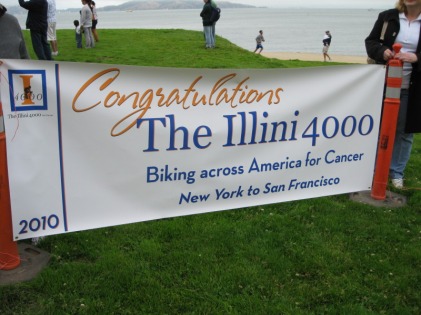
It was quite a life experience and I'm glad I made use of some time off to accomplish this. It was my first major bike tour, previously I'd only done an overnight trip and mostly just half-day rides out of my apartment. I stayed mostly in hotels but I highlighted a few notable hostels and campsites. While I just got back from finishing my own bike tour of the Pacific coast (more on that in a future post), along the way in southern Oregon I came across a group of students from my alma mater, University of Illinois, who were riding across the country and then down the Pacific coast to raise money for cancer. The Illini 4000 comprised 28 riders who have already raised over $100,000 “…for cancer research and support services, as well as awareness of the fight against cancer.”
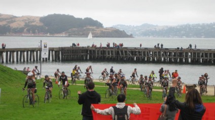
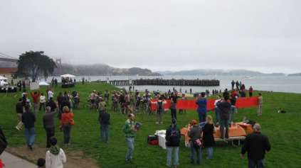
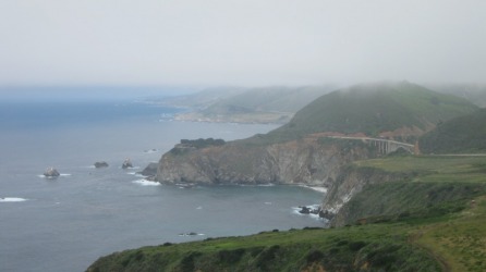
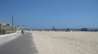
A group of parents, friends, supporters, and Bay Area U of I alumni met them Sunday morning next to the Golden Gate Bridge as they rolled into San Francisco for the conclusion of their summer-long, 4000 mile ride. Congratulations to their group...check out their website for more information or to make a donation. I just completed a bike tour of California's central coast and Southern California. I actually did it in two separate rides, one from San Francisco to San Luis Obispo (through the Big Sur area) and then a few weeks later I went from San Luis Obispo through San Diego to the Mexican border. The northern leg was classic coastal California while the southern part, from Santa Barbara on, was mostly right on the beach in "Baywatch-land". I think I must have pedaled by every single beach in Southern California. All told it was 649 miles (1044.4 km) and 28,471 ft. of climbing (8678 m)--I did it in two separate legs--a three day and a four day trip, so each day I was going a long way. The route was mostly along the ocean, except the first day I deviated not only from the ocean but also the Adventure Cycling route and stayed the night in Buellton, which was the setting of the movie Sideways. Each day was mostly very sunny after the fog burnoff, even in Big Sur, so I now have very pronounced cyclist / farmer tan lines. By the time I got to San Diego, I was applying copious amounts of sunscreen and zinc oxide everywhere--late on the last afternoon I failed to really clean it off and the photos are a little funny of me. Photos of the two legs of the trip are at: http://www.flickr.com/photos/35710734@N05/sets/72157624224826376/show/ and
http://www.flickr.com/photos/35710734@N05/sets/72157624225682311/show/ The Amtrak trips back were not so bad, but a delay leaving in San Diego meant for a long day coming home. I did get really comfortable with having the bike lashed in underneath in the bus' cargo hold, and because Amtrak's Pacific Surfliner train has bike racks in each car, I never had to box it up, which was a nice change. With summer fast approaching, time for an update on the conditions of the Hennepin Canal trail and the I&M Canal trail. As always, for the most current update, contact the respective offices of the the Illinois DNR (see the links page).
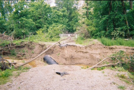
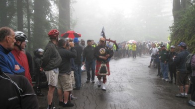
Not too much has yet changed from last year's update. For the Hennepin, work on the two sections that were closed last season is progressing. On the west end, a little east of Colona to about Lock 26, is impassable and closed while on the east end, from approximately Bridge 4 to Lock 3, is closed. For the I&M, two of the three washouts have been fixed, but there is still a closure just east of Utica. There is also another issue with the trail, and this is a no trespassing zone (no "cyclocrossing"!), and so users will need to exit the trail at Utica and use surface streets and rejoin the trail at Buffalo Rock park (or vice versa if heading west). A little video from Stage 3 of the AMGEN Tour of California. This is at the summit of Tunitas Creek Rd. just before Skyline Blvd. (This is at the ridgeline of the coastal hills, at about 2000 ft. / 610m, west of Stanford University on the peninsula between San Francisco and San Jose, CA). There was a nearby KOM point where the slope was greater, making for better race viewing, but I arrived fairly late so I just took a place here at the summit (where the slope was tapering off). There was a little bit of a steady rain near this point in the race which then was a steady drizzle with the redwood trees dropping the moisture on the spectators. Most of the course was dry but I'd kind of planned on watching it here. Oh well.
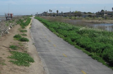
Notice how the three riders in the breakaway are pedaling hard while, given the grade is beginning to flatten here (after about 2000 ft. of climb up from the coastal road), many in the peleton are able to soft pedal. These particular breakaway riders were caught; however, later in the stage, a three person breakaway did get and stay away, with Dave Zabriskie taking the stage win. Zabriskie won last year's Tour of Missouri, which may not be held this year unless it receives further support, see here. While its biking season for some of us, others are skating a lot. While the focus for inline skaters tends to be shorter races, after training for an Elfstedentocht and logging a lot of miles in inline skates, I wondered where the longest paved multi-use trail was in the USA. There are many bike trails and converted rail trails now in the US, but many of these are crushed limestone (suitable for wider, hybrid or mountain bike tires) but fewer paved trails (and even fewer trails with smooth pavement, but that's a more subjective judgment that requires first-hand observation).
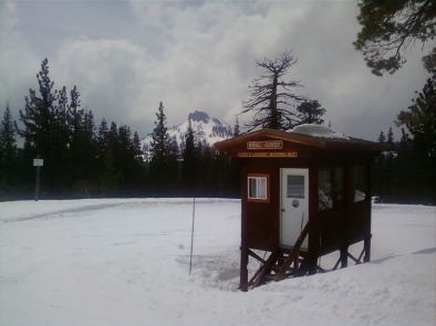
A few paved multi-use trails come to mind for being long paved trails, here's a partial list: Silver Comet (near Atlanta, GA) 61 miles (98 km) Chief Ladiga Trail (AL) 33 miles (53 km) (note it connects to the Silver Comet trail) Little Miami Scenic Trail (OH) 78 miles (126 km) (like several of these, part of a larger network of trails) Mesabi Trail (MN) 75 miles (121 km) Central Lakes Trail (MN) 55 miles (89 km) Lake Wobegon Trail (MN) 62 miles (100 km) (connects to Central Lakes) Trail of the Coeur d'Alenes (ID) 72 miles (116 km) Iron Horse Trail (CA) 33 miles (53 km) Please send any thoughts or comments -- I'm probably missing at least a few great, paved trails and I don't know what the texture of the pavement is. "Paved multi-use trail" can mean a lot of things, from super-smooth "black ice" to rough, almost gravel-like pavement. Also, several trails have added extensions or additional paved mileages so this list may shortly be out-of-date. Finally, I'd never want to say which trail is the "longest", because, like amusement park claims about the _____-est roller coaster, there is a lot of room for variation given that some of the trails connect, others may have short gaps in the paved sections, or some other qualification. Got in one last ski day in the Sierras. This warming hut at the Royal Gorge Cross Country ski area was out of water inside on little tea stove, unfortunately. Still a lot of snow in the mountains in California but its time to transition from winter pursuits to spring / summer sports.
|
Editor - JimThis blog weighs in on topics such as long-distance skating, the Illinois canals, cycling, and a variety of related (and occasionally not-so-related) topics. I'd like to correspond with others interested in skating the Hennepin and I&M canals. Archives
November 2020
Categories |



 RSS Feed