Canal Facts
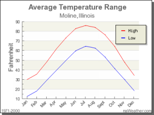
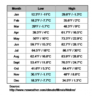
Hennepin Canal Area Climate
The canal freezes solid during periods of extended cold weather. The challenges of any route include the rural nature of the canal (it doesn't run directly through many populated areas) and that many of the bridges are really earthen with a culvert (see below).
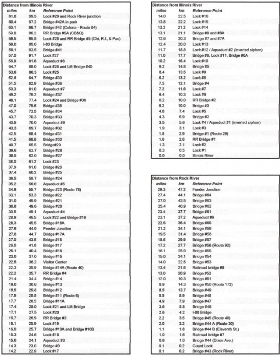
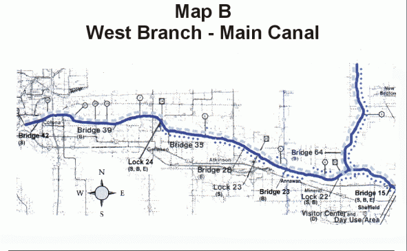
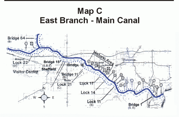
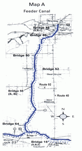
Hennepin Canal Distances And Map
Map from: Friends of the Hennepin Canal, Illinois DNR.
Too Much Portaging?
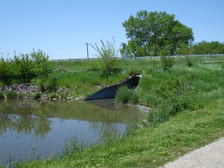
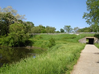
Some of the places where roads cross are typical concrete highway overpasses, while some of the "bridges" are really earthen levees that have culverts that may be passable, and some bridges completely block the waterway:
The information from the Hennepin Canal Visitor Center discusses canoeing:
The Feeder Canal, from Rock Falls to the Summit Pool, is 29 miles of portage free canoeing.
The West End, from the Summit Pool to Lock 26, has larger pools but portaging is required around four locks. The mileages are:
Lock 22 to Lock 23 9.1 miles / 14.6 km
Lock 23 to Lock 24 10.1 miles / 16.2 m
Lock 24 to Lock 25 5.4 miles / 8.7 km
Lock 25 to Lock 26 1.2 miles / 1.9 km
Hennepin Canal Bridges
The culverts present a frequent source of interruption to a thru-skate. The culverts are indeed large, and a canoe or boat can pass through in the summer as they are 12 ft. (3.6 m) in diameter. In the winter, though, the last place on a canal to freeze is typically under a regular bridge, and even later will a canal freeze (if at all) in a tunnel or culvert. While there is "portage-free" canoeing on the Feeder section, most of the bridges there are of the culvert type. The larger highway bridges tend to be more the typical highway construction with the roadbed supported by concrete piers. It is possible that some of the culverts may be passable after an extended period of extremely cold weather--there are reports of snowmobiles passing through the culverts in winter. And also the Rock River in Moline freezes solid enough to support snowmobiles in winter.
The bridges likely would compromise a tour skate. Between the locks and the bridges, roughly every 2 km (1.25 miles) would be interrupted as one would have to portage the obstacle. With the clip-on blade to a cross-country ski boot, this would be possible, but wearing traditional speedskates would be very difficult given the frequent need to portage.
I&M Canal Facts
This page is devoted mostly to the Hennepin Canal facts because it is watered throughout its length. The climate information is fairly similar, and maps are available from Illinois DNR. Note that there are short sections of the I&M Canal that are watered to a sufficient depth, while most of the I&M Canal along its entire length is either dry or like a small creek rather than a stillwater canal (see the Canal Photos page). Illinois DNR's website on the I&M lists the 5 mile (8 km) stretch between LaSalle/Peru and North Utica and the 15 mile (24 km) stretch of open water from Channahon to Gebhard Woods as being suitable for boating.
