Miscellaneous Topics (not about the canals)

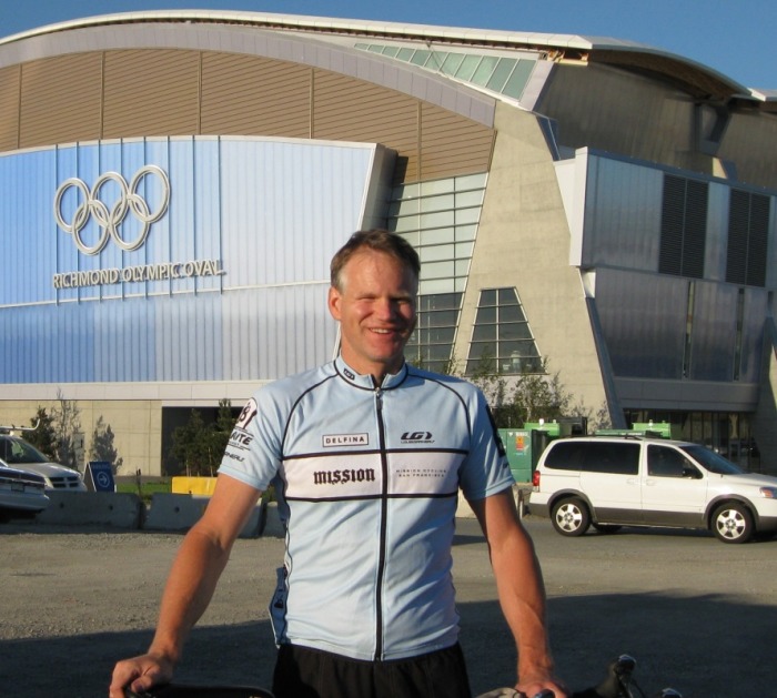
Left: Bike box being loaded onto the plane. Right: At the "official" start of the tour.
Pacific Coast Bike Tour
Day 1: Vancouver, BC to Bellingham, WA. 65.6 miles, 2,624 ft. of climbing (105.7 km, 800 m)
I started my tour by flying from San Francisco to Vancouver on United—the base airfare cost less than the additional $175 fee for the bike—and arrived at the Vancouver airport mid-afternoon and took a cab to a hotel in the nearby suburb of Richmond, BC with the bike still in a box. I chose a hotel next to a bike shop. This gave me a greater confidence in reassembling the bike given I’d never done such an extensive disassembly / reassembly before. I had fears of either the airline or me mangling one of the parts or never getting the cable tension and shifts correct for my journey. In the end, the only reason I needed the bike shop was to purchase a fender and a tire gauge, which I hadn’t managed to accomplish before setting out. That evening, I did a little sightseeing in downtown Vancouver by taking the tram line, which was newly built for the then upcoming 2010 Winter Olympics. I decided my tour would “officially” start the next morning at the Richmond Olympic Oval [speed skating]. It was a short distance from the hotel, and then I could pedal along a crushed stone riverfront bike path and then join up with the Adventure Cycling route a short distance away. Another option would have been to start in Stanley Park, ride through downtown, and then connect with the route, but since I was a speed skater, the Richmond Oval seemed most appropriate.
Riding along the Fraser River leaving Vancouver.
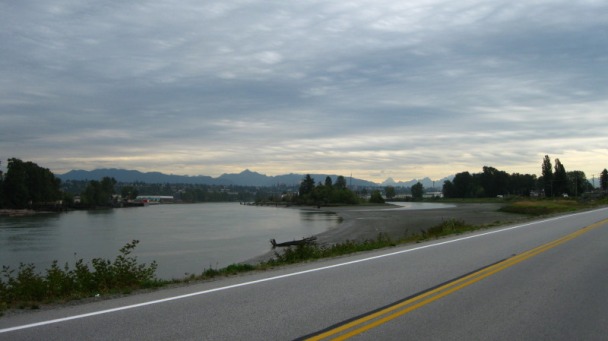
Much of this first day was a ride through the suburbs of Vancouver, and was only mildly interesting as a bike tour. Suburbs in Vancouver look like suburbs just about anywhere, especially the ones on the route. As I approached the Canada – US border, a light drizzle had turned into a steady rain. I was thankful I’d decided I installed the fender the previous day, and as the rain increased I put on my rain gear. At the border, the rain was pretty heavy as I pedaled up to the security booth. Despite having my passport and driver’s license, I was directed to go inside the border office and had to wait in the same line with all the people that had difficulty with their papers. The reason given was that since I had flown to Vancouver, there was no means to track my “vehicle” crossing and then re-crossing the border. I suppose they log vehicle license plates that go over the border and return, and the bike of course has no license plate and was in the cargo hold of the airplane for the journey into Canada. Arrgggh. Nothing worse than standing in a line for half an hour or so in damp gear. I finally was allowed to get going again and the person at the counter was very polite and said a lot of people tour on bikes and I wasn’t that unusual. (Why couldn’t this have been worked out at the car booth window?)
The route continued on into Bellingham and I decided to stay on “motel row” (Samish Way) at a Travelodge. Not only was it affordable, but it had a washer / dryer and was a short walk to an REI and several places to eat. I had managed everything for the bike aspect of the trip, but had no belt for my blue jeans, so yes, the REI was necessary.
The route continued on into Bellingham and I decided to stay on “motel row” (Samish Way) at a Travelodge. Not only was it affordable, but it had a washer / dryer and was a short walk to an REI and several places to eat. I had managed everything for the bike aspect of the trip, but had no belt for my blue jeans, so yes, the REI was necessary.
Day 2: Bellingham, WA to Port Hadlock, WA. 77.9 miles, 4,047 ft. of climbing (125.4 km, 1,234 m; not including another 6 miles on the ferry).
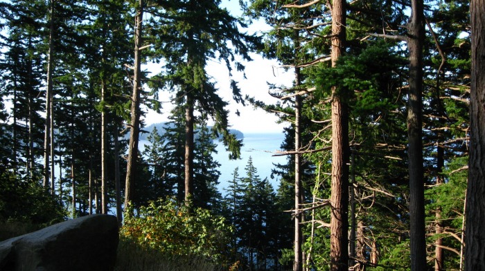
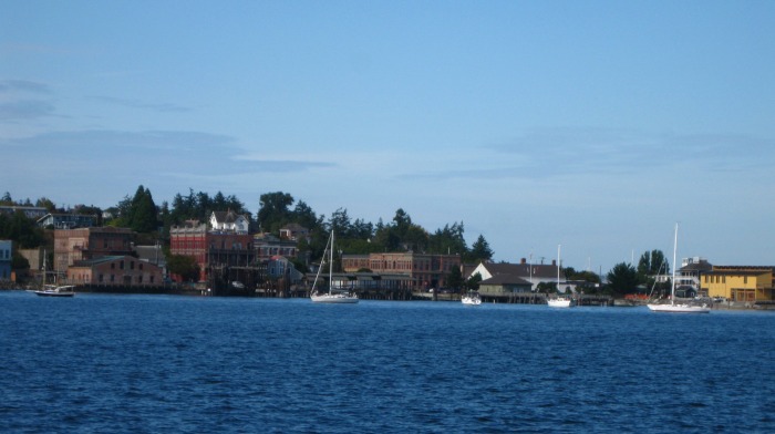
After a first day that was mostly a boring ride through the Vancouver suburbs, an uninteresting rural area at the US-Canada border, a frustrating delay at the border crossing, and a miserable day in the rain, this may have been one of the best days of the entire Pacific Coast tour. The first miles out of Bellingham are on a shelf road perched on a hillside overlooking Bellingham Bay in the Salish Sea. This offered pleasing views of the bay and shoreline with its pine forested hillsides running down to the shoreline, reminding me of the scenery riding around Lake Tahoe (minus the high mountains in the distance). After ten or so miles, the road entered flat farmland, punctuated by interesting sloughs. This section was very serene, I think I saw more cyclists and definitely saw more fisherman than I saw cars here. The route then continued on Hwy 20, which was pretty busy but not terrible after passing Anacortes. After the spectacular Deception Pass, the route takes the rider onto Whidbey Island. This is very scenic, so much so that I didn’t feel cheated in that I didn’t spend a day or two exploring the San Juan Islands. Once past the Ault Field Naval Base, the island becomes very charming, reminding me of little fishing villages in Maine. Coupeville is an enchanting little town near the southern end of the island. I had timed my ride well, and had a short wait for the car ferry to the Victorian era town of Port Townsend. It was still fairly early in the afternoon, and despite the many interesting places to linger in the historic seaport town of Port Townsend, I continued on to Port Hadlock. I stayed at the Inn at Port Hadlock, a very nice hotel right on the bay. This was a nice place, a bit pricey, but worth it.
After a first day that was mostly a boring ride through the Vancouver suburbs, an uninteresting rural area at the US-Canada border, a frustrating delay at the border crossing, and a miserable day in the rain, this may have been one of the best days of the entire Pacific Coast tour. The first miles out of Bellingham are on a shelf road perched on a hillside overlooking Bellingham Bay in the Salish Sea. This offered pleasing views of the bay and shoreline with its pine forested hillsides running down to the shoreline, reminding me of the scenery riding around Lake Tahoe (minus the high mountains in the distance). After ten or so miles, the road entered flat farmland, punctuated by interesting sloughs. This section was very serene, I think I saw more cyclists and definitely saw more fisherman than I saw cars here. The route then continued on Hwy 20, which was pretty busy but not terrible after passing Anacortes. After the spectacular Deception Pass, the route takes the rider onto Whidbey Island. This is very scenic, so much so that I didn’t feel cheated in that I didn’t spend a day or two exploring the San Juan Islands. Once past the Ault Field Naval Base, the island becomes very charming, reminding me of little fishing villages in Maine. Coupeville is an enchanting little town near the southern end of the island. I had timed my ride well, and had a short wait for the car ferry to the Victorian era town of Port Townsend. It was still fairly early in the afternoon, and despite the many interesting places to linger in the historic seaport town of Port Townsend, I continued on to Port Hadlock. I stayed at the Inn at Port Hadlock, a very nice hotel right on the bay. This was a nice place, a bit pricey, but worth it.
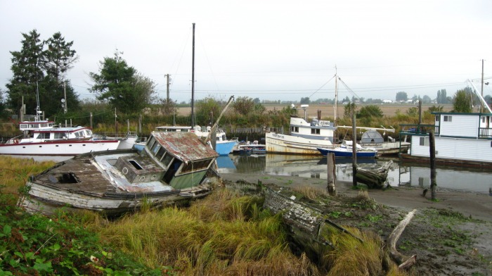
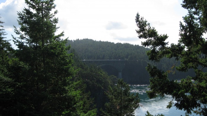
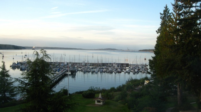
Clockwise, from upper left: views of the bay south of Bellingham, boats line a slough, Deception Pass bridge, tranquil bay off of Whidbey Island, approaching Port Townsend from the ferry, small boat harbor at Port Hadlock.
This day had it all for the touring cyclist: forested views of a tranquil bay in the morning, quiet stretches of farmland (with a few very good farmer’s roadside stands), high bridges over dramatic landscapes, and quaint historic seaport towns. Maybe the best day of the entire Pacific Coast tour.
Day 3: Port Hadlock, WA to Olympia, WA (alternate). 96.1 miles, 5,389 ft. of climbing (154.7 km, 1,643 m; the alternate from Shelton was about 17.5 miles before my friend met me).
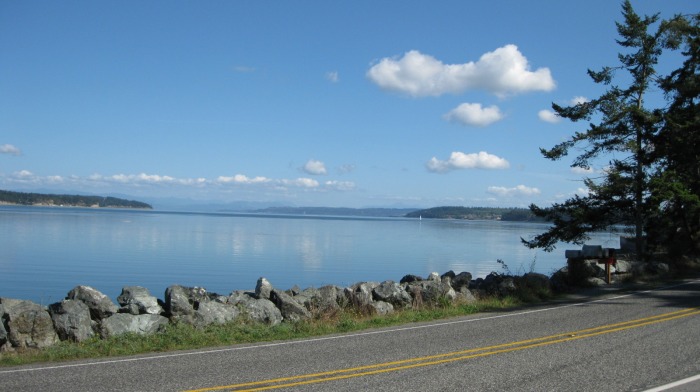
The next day was a run south to Shelton. The scenery was okay, with nice views of the Olympic Mountains jutting up in the distance to the west, the Hood Canal bay, and stretches of forest on either side of the road to go along with small towns and cities. At Shelton, I left the Adventure Cycling route and headed east to Olympia. There isn’t really a great way to do this; Highway 101 is more like an interstate here with 4 lanes and high-speed exit and onramps. This can mostly be avoided by using the access roads and roads such as Old Scenic Hwy 101 that parallel 101, meandering back and forth alongside the current highway. My friend that I was staying with picked me up at the Blue Heron bakery at the edge of Olympia.
Day 3: Port Hadlock, WA to Olympia, WA (alternate). 96.1 miles, 5,389 ft. of climbing (154.7 km, 1,643 m; the alternate from Shelton was about 17.5 miles before my friend met me).
The next day was a run south to Shelton. The scenery was okay, with nice views of the Olympic Mountains jutting up in the distance to the west, the Hood Canal bay, and stretches of forest on either side of the road to go along with small towns and cities. At Shelton, I left the Adventure Cycling route and headed east to Olympia. There isn’t really a great way to do this; Highway 101 is more like an interstate here with 4 lanes and high-speed exit and onramps. This can mostly be avoided by using the access roads and roads such as Old Scenic Hwy 101 that parallel 101, meandering back and forth alongside the current highway. My friend that I was staying with picked me up at the Blue Heron bakery at the edge of Olympia.
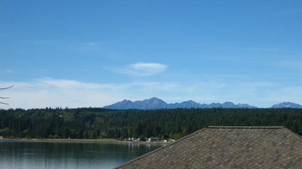
Olympic Mountains in the distance behind the Hood Canal bay.
Day 4: Alternate route of Olympia, WA to Winlock, WA. 58.0 miles, 1,408 ft. of climbing, (93.3 km, 429 m)
I visited with my friend and his family in Olympia before starting out mid-day, so I didn’t plan on travelling as far (especially since the day before had been such a long ride). Very little of the ride was on the Adventure Cycling route other than near the towns of Centralia and Chehalis. As far as the ride, this was almost a rest day given the nature of the route I took. I rolled out of Olympia on the Chehalis Western Trail and then onto the Yelm – Tenino Trail, both of which were paved converted rail-trails.
I then continued on rural roads to Winlock and stayed at the nearby Ranch House B&B. This day was mostly a very peaceful, quiet, scenic ride given the use of the rail-trails.
Day 5: Winlock, WA to Astoria, OR. 85.5 miles, 4,453 ft. of climbing (137.6 km, 1,357 m; alternate from Winlock rejoining route in Castle Rock was about 20 miles. Includes the roughly 1.25 miles on the Cathlamet ferry.)
This day had some scenic highlights, but also was a challenge. The early part of the ride, before I rejoined the Adventure Cycling route, was through a rural area on a grey, foggy Sunday morning. I had my only dog encounters of the entire tour, on two different occasions with snarling, angry dogs greeting me from homesteads, both of which were comprised of a a compound of several rambling, ramshackle buildings giving me the impression the dogs were guarding meth-making operations. I greeted the Columbia River and headed westward. The first twenty miles to Cathlamet have a minimal shoulder, so I put my hands in the drops and hammered through it. At Cathlamet, I blew timing the ferry and so lingered at the grocery store with my lunch until near the time of the next ferry. Once across the Columbia into Oregon, the run into Astoria features a series of forested climbs on the rather busy Hwy 30. Being caught off guard by the relatively tough climbs on Hwy 30 dampened my enthusiasm for this particular day, but I suppose, like Lewis and Clark, there was a sense of satisfaction in reaching Astoria and the Pacific Ocean.
This day had some scenic highlights, but also was a challenge. The early part of the ride, before I rejoined the Adventure Cycling route, was through a rural area on a grey, foggy Sunday morning. I had my only dog encounters of the entire tour, on two different occasions with snarling, angry dogs greeting me from homesteads, both of which were comprised of a a compound of several rambling, ramshackle buildings giving me the impression the dogs were guarding meth-making operations. I greeted the Columbia River and headed westward. The first twenty miles to Cathlamet have a minimal shoulder, so I put my hands in the drops and hammered through it. At Cathlamet, I blew timing the ferry and so lingered at the grocery store with my lunch until near the time of the next ferry. Once across the Columbia into Oregon, the run into Astoria features a series of forested climbs on the rather busy Hwy 30. Being caught off guard by the relatively tough climbs on Hwy 30 dampened my enthusiasm for this particular day, but I suppose, like Lewis and Clark, there was a sense of satisfaction in reaching Astoria and the Pacific Ocean.
The Columbia River.
Day 6: Astoria, OR to Pacific City, OR. 88.7 miles, 4,667 ft. of climbing (142.8 km, 1,423 m)
After a needed laundromat stop early in the morning, I rode over the bridge crossing the mouth of the Lewis and Clark River and turned south. From there, the route is “classic” Oregon coast cycle touring. I was continually encountering and riding with a wide variety other people touring the coast from here to the California border. While the route is nearly all on Hwy 101, the shoulder is pretty wide and the scenery spectacular. Gorgeous beaches, sea stacks reaching skyward defying the elements, quaint small vacation towns, forested capes, parks, bays—this section has everything which is why it is so popular with vacationers and cycle tourists as well. My favorite parts were the forested hillsides and the sandscape by Sandlake. I splurged and stayed the night at the Inn at Cape Kiwanda.
Across the road from the hotel was Cape Kiwanda State Park, which was full of people enjoying the sunny, warm weather at the beach, in the surf in a dory, and viewing the nearby sculptured sandstone cliffs. After a dinner at the brewpub, I was rewarded with a spectacular sunset. There were laundry facilities in the hotel and a nearby grocery supporting the adjoining RV park, which has 10 tent sites. A truly spectacular place to stay and the coffee shop has a computer for use with internet access as a bonus. isco and a short pedal to home.

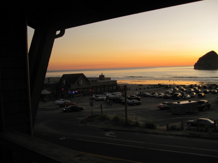
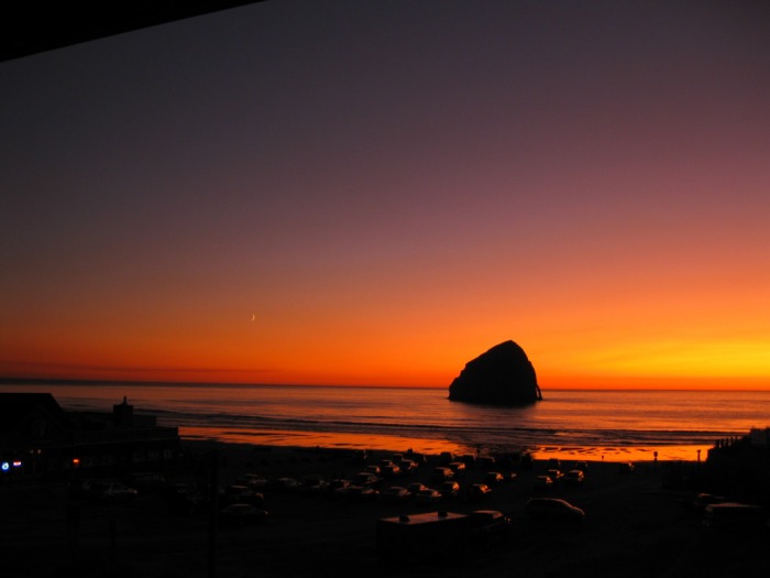
Clockwise from upper left: One of the many amazing views on the Oregon coast, the road running through the dune area south of Sandlake, the brewpub at Cape Kiwanda, glorious sunset at Cape Kiwanda.
Day 7: Pacific City, OR to Florence, OR. 103.7 miles, 5,262 ft (166.9 km, 1,604 m)
Another great day heading south on the Oregon coast. The obvious highlights included the lighthouse at Heceta Head, which if you want, you can stay at the lighthouse keeper’s cottage next door.
Even with it being September, there continued to be a steady stream of fellow touring cyclists given the amazing scenery.

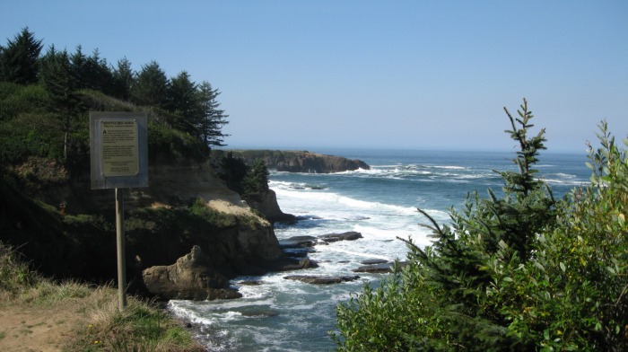
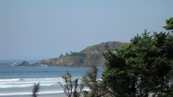

Clockwise from upper left: the ride runs close to the ocean, one of the many scenic points, cape with lighthouse, Heceta Head lighthouse and keeper's house.
[Day 7.1: Florence to Eugene. 80.4 miles, 2,573 ft. (129.3 km, 784 m)]
It was time to end this segment of my tour, so from Florence I headed east towards Eugene. This ride is part of Adventure Cycling’s Transamerica route, and for much of it parallels two rivers. It was in the 90s (> 30 degrees C) by the time I reached Eugene and I “officially” concluded the ride at the University of Oregon’s legendary Hayward Field. From there it was a short ride to the Amtrak station where I had a few hours to clean myself up a bit, box up the bike, and get something to eat. The Amtrak bike box is much bigger than boxes from local bike shops, and all I had to do was take the pedals off, loosen the headset and turn the handlebars sideways. After the overnight train, I arrived in Oakland the next morning, put the bike back together, and hopped on BART for a ride to San Francisco and a short pedal to home.
It was time to end this segment of my tour, so from Florence I headed east towards Eugene. This ride is part of Adventure Cycling’s Transamerica route, and for much of it parallels two rivers. It was in the 90s (> 30 degrees C) by the time I reached Eugene and I “officially” concluded the ride at the University of Oregon’s legendary Hayward Field. From there it was a short ride to the Amtrak station where I had a few hours to clean myself up a bit, box up the bike, and get something to eat. The Amtrak bike box is much bigger than boxes from local bike shops, and all I had to do was take the pedals off, loosen the headset and turn the handlebars sideways. After the overnight train, I arrived in Oakland the next morning, put the bike back together, and hopped on BART for a ride to San Francisco and a short pedal to home.
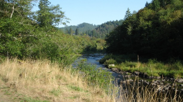
Stream along the road towards Eugene
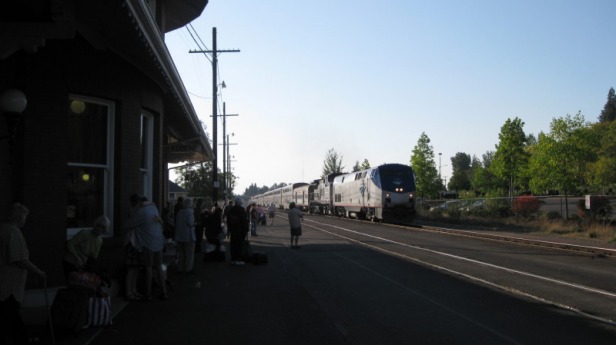
Southbound Amtrak Coast Starlight train at the Eugene train station.
Day 8: Florence to Bandon. 75.1 miles, 3,942 ft (120.9 km, 1,202 m).
It was early afternoon on a July day the following summer when my tour resumed from Florence after I had rented a car, driven to Coos Bay / North Bend, and took a cab to Florence. Okay, this wasn't the most "green" bike tour. Unlike the clear coastal weather of September, Oregon and California are known for coastal fog in summer. Which meant that a lot of what I saw of the Oregon Dunes National Recreation Area was sandy hillsides by the road, a lot of vehicles towing ATVs and dune buggies, and the occasional break in the clouds and fog with views of the dunes. A little disappointing. By the time I got to Bandon, I had put on nearly a full winter ride worth of gear, including vest, turtleneck enjoyed, cap, and leg and arm warmers.
It was early afternoon on a July day the following summer when my tour resumed from Florence after I had rented a car, driven to Coos Bay / North Bend, and took a cab to Florence. Okay, this wasn't the most "green" bike tour. Unlike the clear coastal weather of September, Oregon and California are known for coastal fog in summer. Which meant that a lot of what I saw of the Oregon Dunes National Recreation Area was sandy hillsides by the road, a lot of vehicles towing ATVs and dune buggies, and the occasional break in the clouds and fog with views of the dunes. A little disappointing. By the time I got to Bandon, I had put on nearly a full winter ride worth of gear, including vest, turtleneck enjoyed, cap, and leg and arm warmers.
Day 9: Bandon to Brookings. 86.9 miles, 5,553 ft, (139.9 km, 1,693 m)
Immediately south of Bandon, the road runs through vacation homes and hotels overlooking a rocky coastline, but then, like much of the day before, runs a few miles off the coast with a tree-lined Hwy 101 with fog in the distance, so there weren’t great views until south of Port Orford when the road came closer to the coast again and the fog broke up a bit. As the weather brightened a bit, I was thankful the winds weren’t howling, and there was only a lone kitesurfer at the famous wind sports site of Pistol River.
This day was marred by having to fix two popped spokes on my rear tire, but the wheel held true after my attempts at repair. I stayed at the hiker-biker campsite within Harris Beach State Park near Brookings. The town was only a short mile or so ride south and the giant Fred Meyer grocery store was a welcome site. The next day I took the bike to Escape Hatch Sports and Cycle and had the wheel trued and my poor workmanship fixed.
Day 10: Brookings to Orick. 67.1 miles, 4,049 ft, (108.0 km, 1,234 m)
After Crescent City, the route has a rough climb but the rider is rewarded with the first major redwood groves. The long stretch through the Redwood National Park (and its associated State Parks) was very pleasant and despite a little chill, I enjoyed several stops to take a break and some photos of some of the more massive trees. After a break in the big trees and passing through Klamath, the route continued through more redwood forests and parkland. I had hoped to make it further, but the tough climb out of Crescent City and the late start due to the pit stop at the bike shop resulted in my decision to stop in Orick rather than continue further to a better destination either in Patrick’s Point State Park or one of the nice B&Bs in Trinidad.
After Crescent City, the route has a rough climb but the rider is rewarded with the first major redwood groves. The long stretch through the Redwood National Park (and its associated State Parks) was very pleasant and despite a little chill, I enjoyed several stops to take a break and some photos of some of the more massive trees. After a break in the big trees and passing through Klamath, the route continued through more redwood forests and parkland. I had hoped to make it further, but the tough climb out of Crescent City and the late start due to the pit stop at the bike shop resulted in my decision to stop in Orick rather than continue further to a better destination either in Patrick’s Point State Park or one of the nice B&Bs in Trinidad.
Day 11: Orick to Myers Flat. 107.7 miles, 6,468 ft, (173.3 km, 1,971 m)
Whether it was the compelling scenery spurring me on or my lack of planning, I ended up riding more than I planned this day. Besides the Carson Mansion, Eureka has a multitude of interesting Victorian buildings. Later in the day, I was surprised by the attractive Victorian town of Ferndale (which I had thought would be more the type of little town with a chain gas station and gritty buildings, not upscale historic Victorian era inns and B&Bs—the entire town is actually a California State Historic Landmark). The route also had its share of rural farm roads, and the farm stand south of Ferndale made for a good refueling stop. I continued on and entered The Avenue of the Giants, and because it was late in the day, the road was mostly empty. I joined up with a rider I’d met at the camp in Brookings and we pedaled on through the majestic groves of redwoods for another hour, often not talking in a state of awed reverence.
I was surprised by the lack of services in this area, and opted to stay at the Myers Inn B&B. http://myersinn.com/Default.asp
Another group of cyclists was staying here, with a van support and a father (bucket list bike tour of Pacific Coast) with his son and a couple of family friends along for the tour.
I had thought about the Lost Coast alternative route, but after a conversation with a bike shop person in the Eureka / Arcata area, I decided to skip it as only 6 or so miles is actually on the coast with the rest in the woods. Other reasons I opted to skip the loop included having had mechanical issues (the aforementioned spokes as well as cleat troubles on one shoe) and riding the mega-hills with a loaded touring bike. There are a couple of 1 and 2 day tour events of this same route that I can return and ride on a lightweight road bike instead some day.
Day 12: Myers Flat to Cleone. 85.5 miles, 8,088 ft, (137.6 km, 2,465m)
This day featured a pleasant roll-out, but then after Leggett, a tough climb up and over the coastal hills to the coast. The shoulder wasn’t good, there were a lot of logging trucks and RVs to worry about, and once at the coast, a few pickup trucks gave little quarter to this bicyclist (maybe on purpose). I don’t know—do they not like bicyclists? Or maybe my relatively clean-cut appearance gave them a fear I was working for the DEA. (Humboldt and Mendocino county are now better known for a different crop than lumber.)
http://www.cnbc.com/id/28281668/
http://www.hulu.com/watch/54312/cnbc-originals-marijuana-inc
It was still going to be foggy, so I opted to stay at the Cleone Garden Inn rather than wake up to a cool, clammy morning. Nice place with a wonderful hot tub to soak away the soreness and nearby a good Mexican restaurant in the Purple Rose. There is also a private campground and grocery store nearby as well.
Day 13: Cleone to Ft. Ross. 87.8 miles, 5,555 ft, (141.3 km, 1,693 m)
Lots of seaside riding highlighted this day, which included a coffee break in the quaint town of Mendocino (or Spendocino as some people call it). Since it would actually be my last night on the tour (I did the Washington – Oregon section in fall of 2009 and the San Francisco – San Diego section earlier in the summer), I opted to splurge and stay at The Timber Cove Inn and treat myself to a few glasses of fine wine and dinner overlooking the ocean. http://www.timbercoveinn.com/
Lots of seaside riding highlighted this day, which included a coffee break in the quaint town of Mendocino (or Spendocino as some people call it). Since it would actually be my last night on the tour (I did the Washington – Oregon section in fall of 2009 and the San Francisco – San Diego section earlier in the summer), I opted to splurge and stay at The Timber Cove Inn and treat myself to a few glasses of fine wine and dinner overlooking the ocean. http://www.timbercoveinn.com/
Day 14: Ft. Ross to San Francisco. 91.6 miles, 5,972 ft, (147.5 km, 1,820 m)
The road from Ft. Ross to Jenner is a tough stretch where the road is narrow and winding with little and mostly no shoulder. I benefitted from riding this in the early morning when few cars shared the road with the exception of some state park workers and a few other vehicles. I rode hard to minimize my time in the stretch, so it had already been a pretty tough morning by the time I made it to Jenner, which is where the Russian River empties into the sea. I then made a stop in Bodega Bay for “breakfast”. The schoolhouse from “The Birds” is actually in the town of Bodega, just off the route several miles to the south. Once the route made it to the small town of Marshall and Tomales Bay, I was on autopilot to home on roads I know well from weekend rides from San Francisco. I stopped for lunch in Olema (as I do sometimes when I ride these roads on regular training rides) before continuing on through Marin into San Francisco. At the Golden Gate Bridge, I stopped to collect myself and put on some warmer clothes for the windy ride across the bridge. The wind was blowing a consistent 25 mph, with higher gusts, and at the towers, the wind is even greater—this is not unusual at all on a summer afternoon here. At least it was after 3:30 pm and the west sidewalk opens for bikes only, and fortunately the cool weather kept the hordes of tourist rental bikes away so it wasn’t too dangerous (despite no shoulders, highways, and other dangers of the road on the Pacific Coast tour, the bridge can be one of the more dangerous spots given the narrow sidewalk and distracted tourists on rental bikes). With construction coming soon, the “bikes only” west sidewalk may be closed for a while in 2010 and 2011, which will probably mean walking the bike for extensive stretches during tourist season.
The road from Ft. Ross to Jenner is a tough stretch where the road is narrow and winding with little and mostly no shoulder. I benefitted from riding this in the early morning when few cars shared the road with the exception of some state park workers and a few other vehicles. I rode hard to minimize my time in the stretch, so it had already been a pretty tough morning by the time I made it to Jenner, which is where the Russian River empties into the sea. I then made a stop in Bodega Bay for “breakfast”. The schoolhouse from “The Birds” is actually in the town of Bodega, just off the route several miles to the south. Once the route made it to the small town of Marshall and Tomales Bay, I was on autopilot to home on roads I know well from weekend rides from San Francisco. I stopped for lunch in Olema (as I do sometimes when I ride these roads on regular training rides) before continuing on through Marin into San Francisco. At the Golden Gate Bridge, I stopped to collect myself and put on some warmer clothes for the windy ride across the bridge. The wind was blowing a consistent 25 mph, with higher gusts, and at the towers, the wind is even greater—this is not unusual at all on a summer afternoon here. At least it was after 3:30 pm and the west sidewalk opens for bikes only, and fortunately the cool weather kept the hordes of tourist rental bikes away so it wasn’t too dangerous (despite no shoulders, highways, and other dangers of the road on the Pacific Coast tour, the bridge can be one of the more dangerous spots given the narrow sidewalk and distracted tourists on rental bikes). With construction coming soon, the “bikes only” west sidewalk may be closed for a while in 2010 and 2011, which will probably mean walking the bike for extensive stretches during tourist season.
Day 15: San Francisco to Watsonville. 104.3 miles, 4,438 ft (167.9 km, 1,353 m)
This ride is a nice ride out of San Francisco down the coast with some great scenery. Surf spots like Mavericks, and two lighthouses that double as hostels are along this segment. The ride through Santa Cruz was great as it was afternoon and a fair amount of UC Santa Cruz students rode alongside and then later in the day, fitness cyclists out on their road bikes. I enjoyed it so much I simply kept going, and stayed the night in Watsonville.
This ride is a nice ride out of San Francisco down the coast with some great scenery. Surf spots like Mavericks, and two lighthouses that double as hostels are along this segment. The ride through Santa Cruz was great as it was afternoon and a fair amount of UC Santa Cruz students rode alongside and then later in the day, fitness cyclists out on their road bikes. I enjoyed it so much I simply kept going, and stayed the night in Watsonville.
Day 16: Watsonville to Ragged Point. 108.8 miles, 9,081 ft (175.1 km, 2,768 m)
The Big Sur day. I once had a boss from the United Kingdom who worked in the US who said he thought this was the most beautiful place in the world. I’m not quite as enthusiastic but much of it is pretty amazing. (Note that I ride a lot on the slopes of Mt. Tamalpais and the Marin Headlands, so in one sense, Big Sur is just a more dramatic version of my average ride). After the seaside flats around Monterey Bay, the route climbs its way out of the edge of the town of Monterey. Besides great views of the coast, the obvious highlights of Big Sur include the Bixby Bridge, Point Sur, and the many dramatic vistas. Lodging along this stretch takes the form of 1) camping, 2) decent but a somewhat quirky places (Deetjens, Esalen), and 3) extremely expensive spas (Post Ranch, Ventana). Some of the places to camp cater to families in cabins while others lack nearby groceries (however the campgrounds south of Lucia are pretty amazing sites but plan ahead for food, with Kirk Creek standing out). I stayed at the reasonably affordable Ragged Point Inn after what was a monster of a day in the saddle.
The Big Sur day. I once had a boss from the United Kingdom who worked in the US who said he thought this was the most beautiful place in the world. I’m not quite as enthusiastic but much of it is pretty amazing. (Note that I ride a lot on the slopes of Mt. Tamalpais and the Marin Headlands, so in one sense, Big Sur is just a more dramatic version of my average ride). After the seaside flats around Monterey Bay, the route climbs its way out of the edge of the town of Monterey. Besides great views of the coast, the obvious highlights of Big Sur include the Bixby Bridge, Point Sur, and the many dramatic vistas. Lodging along this stretch takes the form of 1) camping, 2) decent but a somewhat quirky places (Deetjens, Esalen), and 3) extremely expensive spas (Post Ranch, Ventana). Some of the places to camp cater to families in cabins while others lack nearby groceries (however the campgrounds south of Lucia are pretty amazing sites but plan ahead for food, with Kirk Creek standing out). I stayed at the reasonably affordable Ragged Point Inn after what was a monster of a day in the saddle.
Day 17: Ragged Point to San Luis Obispo. 62.8 miles, 1,842 ft (101.1 km, 561 m)
After Ragged Point, the road descends and is mostly flat to San Luis Obispo. The landscape is more of a coastal plain with dry grasses and the hills well back from the ocean (compared to Big Sur where Hwy 1 hugs the hillside in many places). Nice stops along the way to view the sea lions on the beach and if you want, a diversion to tour the Hearst Castle at San Simeon (I passed on it given time constraints). I had ridden so far the previous day because I was riding this section in just three days and planned to catch the Amtrak Coast Starlight train to home in the middle of the afternoon of the third day. The miles went by quite quickly given the relatively flat route, so I hadn’t needed the time I had thought to be ready for the Amtrak train in San Luis Obispo. Even with a long stop for lunch, I still ended up being so early that the Amtrak gate agent suggested that I take the bus (leaving just 15 minutes after I got there). This ended up being fortuitous as I didn’t have to disassemble anything and box it up, and was allowed to bungee the bike to the support beams in the cargo hold underneath the bus. Other than racks on trains, this has to be the best way to travel with a bike, but Amtrak’s rules are inconsistent, in part because they often use private contractors for the bus connector service, so call in advance if you are thinking of taking the Amtrak bus.
After Ragged Point, the road descends and is mostly flat to San Luis Obispo. The landscape is more of a coastal plain with dry grasses and the hills well back from the ocean (compared to Big Sur where Hwy 1 hugs the hillside in many places). Nice stops along the way to view the sea lions on the beach and if you want, a diversion to tour the Hearst Castle at San Simeon (I passed on it given time constraints). I had ridden so far the previous day because I was riding this section in just three days and planned to catch the Amtrak Coast Starlight train to home in the middle of the afternoon of the third day. The miles went by quite quickly given the relatively flat route, so I hadn’t needed the time I had thought to be ready for the Amtrak train in San Luis Obispo. Even with a long stop for lunch, I still ended up being so early that the Amtrak gate agent suggested that I take the bus (leaving just 15 minutes after I got there). This ended up being fortuitous as I didn’t have to disassemble anything and box it up, and was allowed to bungee the bike to the support beams in the cargo hold underneath the bus. Other than racks on trains, this has to be the best way to travel with a bike, but Amtrak’s rules are inconsistent, in part because they often use private contractors for the bus connector service, so call in advance if you are thinking of taking the Amtrak bus.
Day 19: Buellton to Malibu. 115.8 miles, 4,951 ft (186.4 km, 1,509 m; alternate Buellton to Santa Barbara was 38 miles, 3,046 ft.)
I rode from Buellton and toured Solvang a little bit before continuing on. I made the mistake of not following the Adventure Cycling route on Hwy 101 to Santa Barbara and instead took Hwy 154 over the coastal range to Santa Barbara. Much of it was nice, but the winding stretch by Lake Cachuma with no shoulder was one of the worst parts of my entire tour, even with it being early on a Sunday morning. Dangerous. Once I descended into Santa Barbara, the sun was shining brightly and I stopped to replace a spare tube after I had flatted near the summit. After Santa Barbara, the route follows Hwy 1 south along many beaches. Scenic but a bit challenging in the summer as I had to balance sightseeing with being vigilant about the vehicles on the roadway to the left and the RVs and cars sharing the shoulder with me. I managed the feet of not being doored by one of the many cars.
I rode from Buellton and toured Solvang a little bit before continuing on. I made the mistake of not following the Adventure Cycling route on Hwy 101 to Santa Barbara and instead took Hwy 154 over the coastal range to Santa Barbara. Much of it was nice, but the winding stretch by Lake Cachuma with no shoulder was one of the worst parts of my entire tour, even with it being early on a Sunday morning. Dangerous. Once I descended into Santa Barbara, the sun was shining brightly and I stopped to replace a spare tube after I had flatted near the summit. After Santa Barbara, the route follows Hwy 1 south along many beaches. Scenic but a bit challenging in the summer as I had to balance sightseeing with being vigilant about the vehicles on the roadway to the left and the RVs and cars sharing the shoulder with me. I managed the feet of not being doored by one of the many cars.
Day 20: Malibu to Dana Point / Capistrano Beach. 86.6 miles, 1,451 ft (139.4 km, 442 m)
After leaving Malibu, the route uses a lot of beach paths through Santa Monica, Venice, Manhattan and Hermosa Beach. It then goes inland through Torrance and Carson and back out to Long Beach. The sun broke through the fog by the time I made it to Long Beach and the beaches filled up, even with it being a weekday. I finished at a Quality Inn in Dana Point / Capistrano Beach that was surprisingly affordable by LA standards (under $100), had a washer / dryer, and the nearby restaurant had a special on $1 bottles of beer with dinner. BARGAIN! Nice sunset and then a good night’s sleep. Despite this being a flat stage of the tour, it was very slow going given the many stops and also the bike paths got more crowded with beachgoers as the day progressed. It was one of my slowest days, and certainly the slowest of the “flat” days. And while it’s near the beach, the part in LA was not at all scenic—for instance, BP oil refineries are certainly not very appealing to most people.
After leaving Malibu, the route uses a lot of beach paths through Santa Monica, Venice, Manhattan and Hermosa Beach. It then goes inland through Torrance and Carson and back out to Long Beach. The sun broke through the fog by the time I made it to Long Beach and the beaches filled up, even with it being a weekday. I finished at a Quality Inn in Dana Point / Capistrano Beach that was surprisingly affordable by LA standards (under $100), had a washer / dryer, and the nearby restaurant had a special on $1 bottles of beer with dinner. BARGAIN! Nice sunset and then a good night’s sleep. Despite this being a flat stage of the tour, it was very slow going given the many stops and also the bike paths got more crowded with beachgoers as the day progressed. It was one of my slowest days, and certainly the slowest of the “flat” days. And while it’s near the beach, the part in LA was not at all scenic—for instance, BP oil refineries are certainly not very appealing to most people.
Day 21: Capistrano Beach to San Diego border area. 88.8 miles, 2,170 ft (142.9 km, 663 m; not including 1.7 miles on Coronado ferry)
After the route goes through the relatively unpopulated San Clemente and San Onofre state beach areas, it runs through the active military base of Camp Pendleton. Access is controlled here, so plan ahead and know when (or even if) you may ride through on a given day. South of Camp Pendleton, the route runs through the coastal communities of the San Diego metro area. This was generally a pleasant ride, more so than through LA, and I enjoyed passing the many beaches and towns along the way. I took the ferry to Coronado, and tagged along with three young guys out for an afternoon ride on their road bikes. This helped immensely as the wind was actually from the south here, so riding in a paceline helped a lot given it was late in the day and I was more tired. After a ride through the Imperial Beach suburb, the route became more thinly populated close to the border (I once read a novel about a surfer / worm farmer who lived in this area). Eventually, it ends in a weird, otherworld of a dusty road going through scrub brush, with the only company being Border Patrol pickups crossing over the paved road going four-wheeling over the landscape while doing their job. The road eventually was flooded in the Border Field State Park, so I’d have had to offroad it to pedal out to the end of the road at the ocean. The Park was mostly closed given California’s budget woes, and the stark emptiness of this area kind of made for a strange end to the ride given its weird loneliness.
The ride from the “official” end of the Pacific Coast route to the San Diego trolley at San Ysidro was easy, and had a nice bike lane for most of the few miles to the station. After the hour-long ride on the trolley, I checked into the 500 West hostel / hotel, which was quite affordable and nice for a downtown area and right next to the San Diego Amtrak station for the trip home, which was supposed to start with the 6:10 am train the next day. It took all day to get back to my car in San Luis Obispo on a combination of trains and Amtrak buses, but after a pitstop for a big iced tea, I drove the rest of the way back to San Francisco and got home just after 9 o’clock at night. Tired, but happy.