Hennepin Canal Photos
Canal Photo Survey
This slideshow is a survey of the Hennepin Canal, focusing on the bridges and locks, as well as covering some of the surrounding scenery. The survey begins at the eastern end near Bureau Junction, IL and continues west to the terminus at the Rock River in Colona, IL. It picks up again in Rock Falls, IL, and goes south to the summit pool. Note that the URL for the show is at http://www.flickr.com/photos/35710734@N05/sets/72157621940514333/show/
Notes and Photos of the Hennepin Canal in Winter, 2008 - 2009
I didn’t make it to the canals this winter to skate, but I did obtain a lot of firsthand observations to pass along from a variety of helpful folks. The last time I skated the I&M several years ago was after a month where the temperatures didn’t even break freezing for the high of the day. The ice then was quite bumpy, and moreover, I found it daunting to skate next to the open-water Illinois River, separated only by the narrow strip of land. The canals were again frozen solid this winter.
The Hennepin canal had some really solid ice this winter, albeit it was snow-covered most of the time and when it wasn’t, there’s the caveat that at the locks and at the bridges (see the culvert / pipe photos on the Canal Facts page) the greater current prevented solid freezing at some locations along the length of the canal during the warmer periods. The winter that was had a December cold period, followed by a thaw towards New Years, then a very cold January with snow, and finally an early thaw by mid-February. At one location in the western section of the canal, the ice was nearly 10 inches (25.4 cm) thick on December 28, this after a couple of days in the 50s (~12° C) and even a little rain. However, near Rock Falls, at one of the culvert-style bridges, there was a little bit of open water during this time.
By mid-January, after the cold weather that included a record-breaking cold snap (as low as -27°F / -33°C at Moline airport), the ice was nearly 18” (45.7cm) thick in places, but it was snow covered. Early February brought a period where the snow melted, but the skateable window quickly shut. The weekend of February 7 and the subsequent week brought several days where the high temperature climbed to roughly 60°F (15.5°C), and despite the ice being nearly 20” – 24” (51 – 61cm) thick in one location on Feb 7, by the next weekend these warm temperatures mostly melted the ice as far as skating was concerned. For most of January, the canal had had good ice, but it was buried under snow—the stats for Moline airport were a seasonal total of 40.3” (102 cm) on February 7, compared to a normal total of 23.9” (60.7cm) on that date (with 35.0” / 88.9cm being a normal seasonal total).
Oh well, “wait ‘til next year” as they say. Many thanks to all of you who provided feedback and corresponded with me this past winter. At least I did get to experience good ice in Europe and the Nordic countries this winter—see the Blog and Other Photos pages--note that for the events that I skated in Europe the organizing committees plowed and/or brushed away any accumulated snow.

Some ice fisherman out on the Hennepin Canal in the western section on December 28. Photo courtesy of Fishing- Headquarters.com
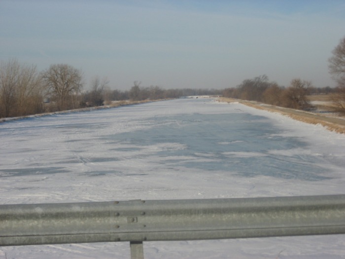
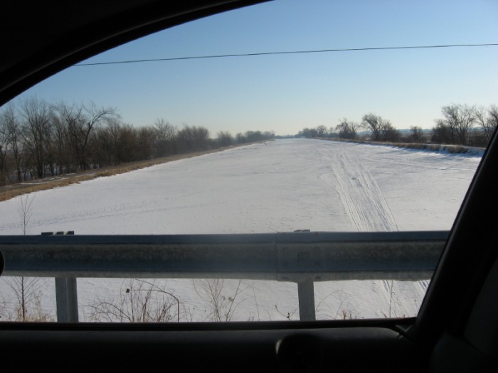


February 5, the last day before the thaw began. Clockwise from upper left: looking east from 475E near Sheffield; looking east from the summit pool area at 400E; looking west from 575E near Sheffield; looking east from 675E.
Illinois and Michigan Canal Photos
The pictures below are of my bicycle trip on the I&M Canal. Note the older condition of the canal, while the I&M's locks are made of stone, while the Hennepin's locks are concrete. The state of the canal varies--in various places along its length its a true canal with a clear, navigable waterway while in other places it can be a creek, a stangnant algae-filled pool, a puddle that is only filled after a recent rain, or even just a depressed place in a grass field along its path. According to Illinois-DNR, there are only two watered sections of the I&M are suitable for canoeing (and consistently good skating)--the 5 mile (8 km) stretch between LaSalle/Peru and North Utica and the 15 mile (24 km) stretch from Channahon to Gebhard Woods State Park.
From the pictures below, you can see a skate would be difficult. I did manage to skate the canal in the brutally cold winter of January, 2001, west of Channahon. Although it was under repair in parts and it was a little unnerving to skate the canal in that stretch as right next to it, separated only by a narrow strip of land containing the towpath, was the very unfrozen Illinois River.


